18+ Years of Partnership
17,000+ Agencies Served
700k+ Platform Users

Enhanced situational awareness
by ensuring real-time updates and mapping accuracy.

Consistent, scalable navigation
via USNG overlay

Improved coordination across jurisdictions
through shared custom map markers
The IaR platform plays a critical role in streamlining emergency communications, enabling faster response times through real-time incident alerts, responder tracking, and integrated mapping tools. Known for its reliability and ease of use, IaR empowers departments of all sizes, from rural volunteer fire stations to major urban response teams, by enhancing coordination, improving situational awareness, and reducing response delays through intelligent, connected solutions.
Upgrading Mapping with Advanced Views
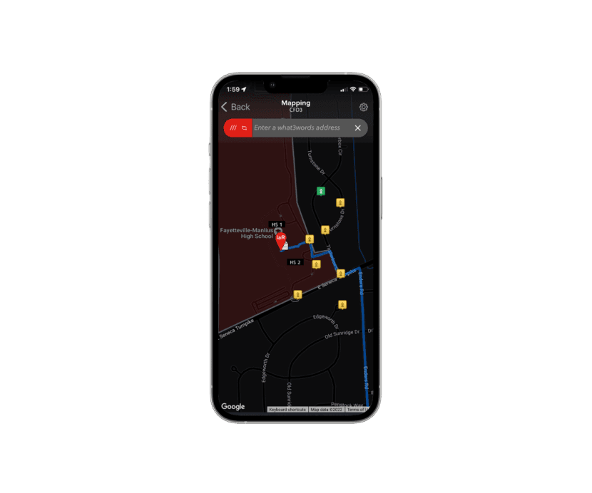
One area of focus for Definity First was upgrading the mapping capabilities within the IaR's platform. Emergency responders now have access to multiple map views such as Roadmap, Satellite, Terrain, Hybrid, and Street View. These views provide various levels of detail and context, from standard map views to real-world images and elevation changes. Users can switch between perspectives depending on the nature of the incident, enhancing pre-arrival planning and on-the-ground decision-making. For example, satellite and terrain views help responders assess natural barriers, while the street view aids in visualizing access points or building layouts before arriving on scene.
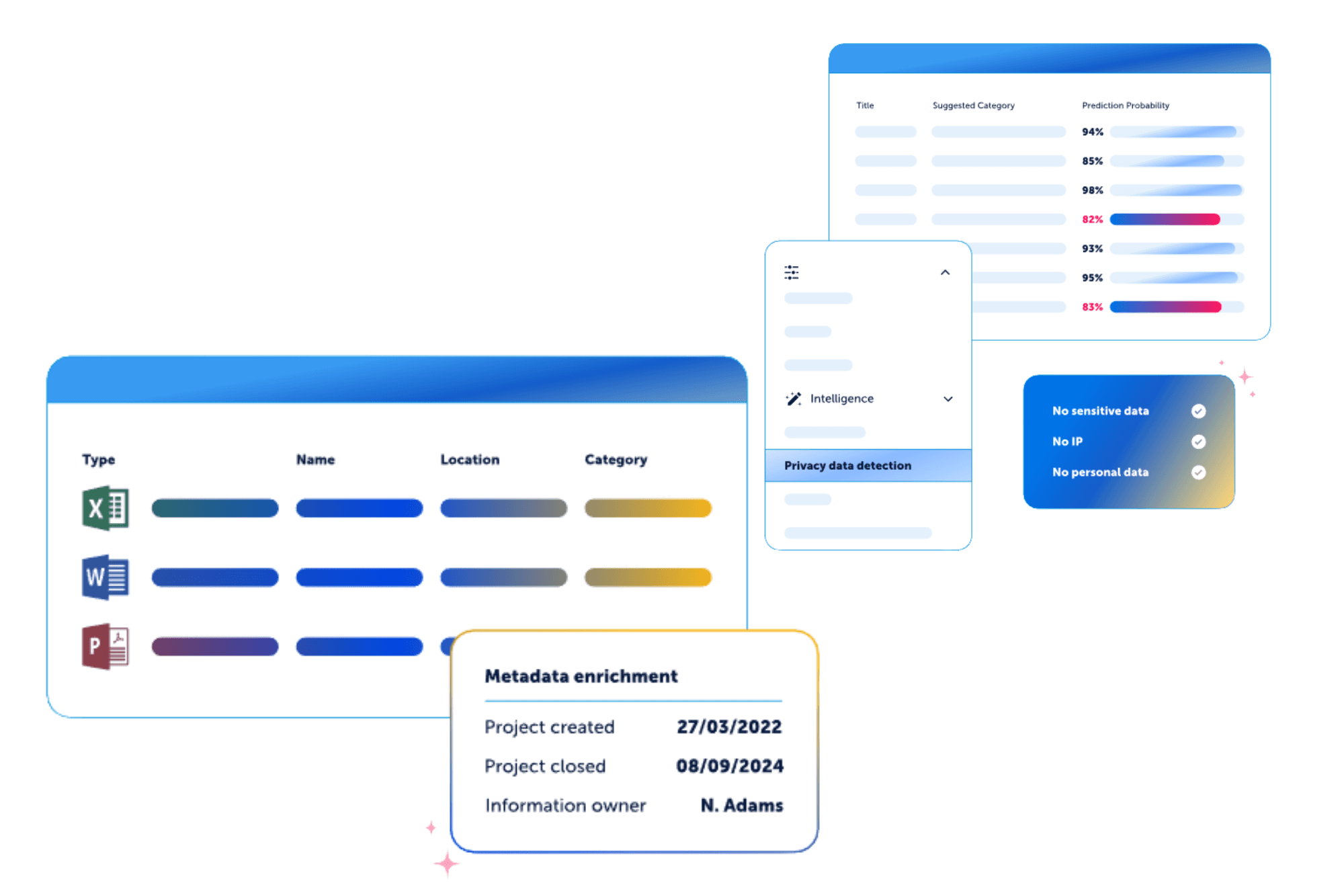
Additionally, building map overlay data was integrated into the platform. These layers can include data such as building maps, floor plans, and jurisdictional boundaries, which are crucial for incident response and management. The data layers are available on both the dashboard and mobile applications, allowing users to select and visualize the relevant information and resulting in quicker, more efficient responses.
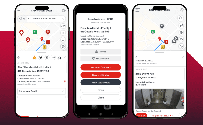
Integrating GPS into the Mix
IamResponding is constantly improving and extending their platform in order to provide the latest technology to their customers. One of these areas of improvement was intelligently integrating GPS coordinates from CAD systems to provide more precise geolocations. Now, when GPS data is available, the system automatically associates the coordinates with the incident address, even in cases where the CAD message is unstructured or incomplete. With this, responders can pinpoint incident locations with high accuracy, enabling them to receive accurate route guidance, reducing delays and improving overall situational awareness.
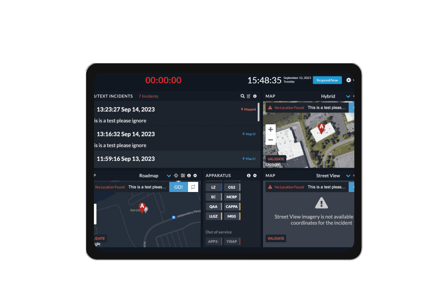
Launching Additional Map Tools
Several advanced mapping tools were integrated into the platform to support field-specific needs. One tool that was implemented allows users to calculate distances quickly and easily on the map, helping fire response teams estimate hose lengths, determine evacuation perimeters, or predict the potential spread of hazardous materials. Additionally, the U.S. National Grid (USNG) overlay was implemented to support agencies that rely on grid-based navigation. This feature offers consistent, scalable reference points for operations in both rural and urban settings.
Another important feature that Definity First worked on was hydrant and map markers. Agencies can now upload and manage custom map markers and hydrant locations directly within the IaR portal. This includes not only their own assets but also mutual aid hydrants and markers from nearby departments. In large-scale or multi-agency incidents, this feature significantly improves coordination, allowing separate teams to share and visualize key infrastructure across jurisdictional boundaries.
Faster response times
by providing structured, real-time incident information.
Increased accuracy
in identifying incident locations and dispatched units.
Improved Coordination
across jurisdictional boundaries with shared map markers.
“ I’m genuinely proud to work alongside the amazing team at Definity. The projects that we are building together are reducing response times, improving situational awareness for responders, and ultimately saving lives. Kudos to everyone on the team, excellent work, and thank you for everything you’ve done.”

Mike Heneka
Senior Project Leader, RapidSOS


Download the full IAR story
Discover More Success Stories